 Dawn on the Malahat
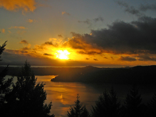
 Malahat is an unincorporated district on the western side of the Saanich inlet on Vancouver Island, inhabited by First Nations People. It actually begins in Goldstream Provincial Park and its end point is at the southern end of Mill Bay. It is a great area to hit up to get a look at the coastal scenery northwest of Victoria. You can get to Malahat by traveling north out of Victoria on the Trans-Canada highway for about 16 kilometers (10 miles).[1] Once you hit Malahat Drive, the road continues along Finlayson Arm before ascending up Malahat Ridge where the views span the Saanich Inlet of the Gulf Islands and includes the Lower Mainland and the distant peaks of Mount Baker in the state of Washington.[2]
References:
Carroll, Donald. Insider’s Guide Canada. Edison: Hunter Publishing, Inc, 1996. ISBN: 1556507100.
“Malahat.” < http://en.wikipedia.org/wiki/Malahat>
[1] Malahat
[2] Carroll, 68
|


